Watershed Ecosystem Services Tool
The WESTool allows users to explore how ecosystem services, land uses and socioeconomic factors interact across Cambodia’s landscapes. By combining advanced science with intuitive maps and tools, the WESTool offers valuable information at the local, regional and national scale to support decision-makers and land managers who wish to understand and balance the value of remaining forests with development goals.
How was the WESTool developed?
Through a research effort led by the United States Agency for International Development Supporting Forests and Biodiversity Project (USAID SFB), land use and land use change mapping were combined with advanced hydrological modeling and scientific analyses to assess key ecosystem services across Cambodia’s landscapes. These analyses were integrated with information on land use and socioeconomic factors to better represent the complex role that ecosystem services play in Cambodia’s society and economy. Click here to read the Watershed Ecosystems Services Tool handout.
Ecosystem Services and Socioeconomic Factors
The WESTool estimates land use change, carbon stocks, greenhouse gas emissions, sediment and nutrient loss, changes in river water quality, impacts on biodiversity, population, access to market, and general agricultural production data at the national and local levels in Cambodia. These estimates were produced by integrating current land use information with historical land use change maps with a hydrological model (SWAT).
Click the buttons below to explore the key ecosystem services and socioeconomic factors the WESTool offers information on, as well as a brief explanation of the methods and data.
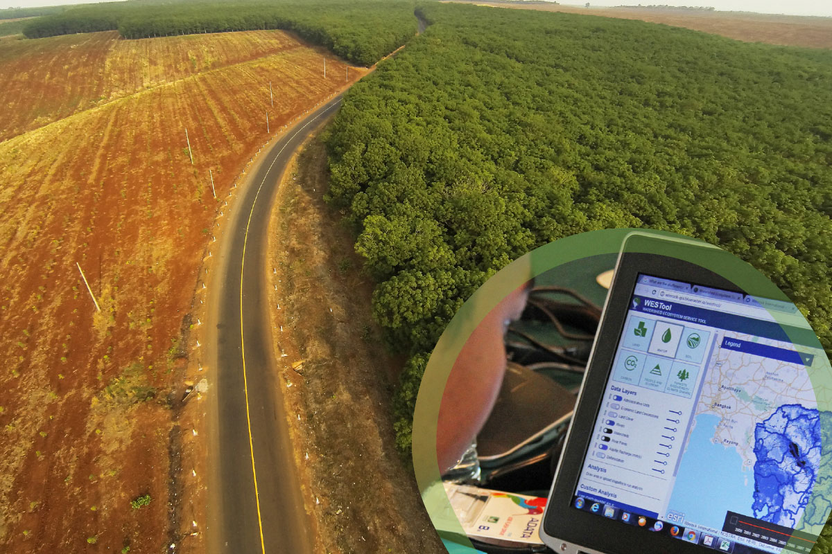
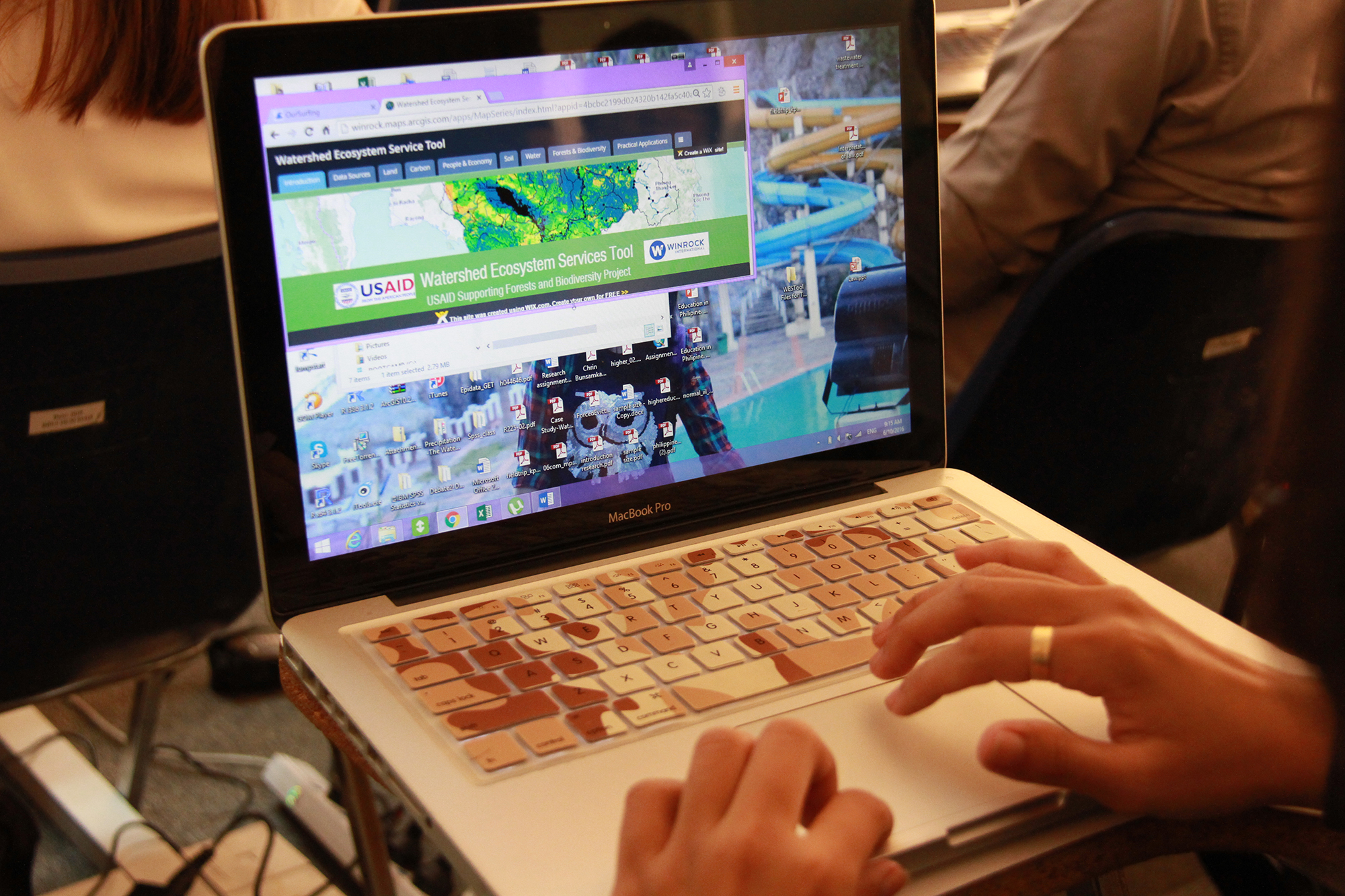
Getting Started
To use the WESTool, click an image below (map opens in new window) and use the map to explore ecosystem services across Cambodia’s landscapes. Each map offers a set of data layers that describe physical attributes of a landscape or land use impacts.
Data layers can be viewed individually or simultaneously using the ‘map layers’ function. To instantly generate information on ecosystem services, click a specific point on the map or use the tools in the Toolbox to draw a shape or upload a GIS shapefile and get information for that specific area of interest. A pop-up box will appear offering information about the ecosystem services within that particular area.
Who is the WESTool for?
The WESTool is a valuable resource for anyone interested in learning more about the the impacts of land use change on forest ecosystem services, people and the economy in Cambodia. The tool provides for a more comprehensive understanding of the implications of land management decisions by offering information on both the historical impacts of land use change and the current value of ecosystem services.
Land Use Managers: The WESTool offers useful information and analyses for those making development decisions, such as the conversion of forests to other developed lands like croplands or plantation. Users can select the area on the map they are considering for development (i.e., an area of forest) and get information on current carbon stocks, potential GHG emissions, sediment and nutrient loss from erosion, and water pollution, as well as information on biodiversity, population and potential land productivity. This information can help land managers compare the potential benefits associated with development with possible negative impacts on ecosystem services.
Private Companies: For companies interested in learning about the historical impacts of their activities or minimizing their environmental impacts into the future, the WESTool may offer useful information on the value of existing ecosystem services in an area they are considering for development.
Water Facilities Managers: Land use and land use change can impact water quality and quantity, and the WESTool offers useful information to those looking to understand the impact that past land use has had on water flow, quality and quantity.
Researchers: WESTool provides valuable information for researchers interested in assessing land management decisions and exploring potential impacts of development anywhere in Cambodia.
Saving Cambodia’s Ecosystem – One Click at a Time
Winrock’s Ecosystem Services Team is on the Job
How to Cite WESTool
Watershed Ecosystem Service Tool (WESTool). 2017. Beta Version 1. https://winrock.org/westool/. Winrock International